
Flood risk

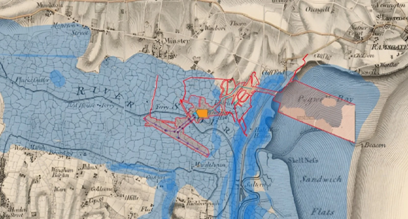
Project overlayed on old Wantsum Sea Channel,
Showing the location of the soft alluvial clay this project is proposed to sit on.
The Sea Link converter station is being built on land that’s prone to flooding.
A Site Prone to Flooding
The chosen location is in Flood Zone 2, and an area of high ground water flood risk. (As you can see by the photo.)
Why? The land is flat and low-lying, sitting at sea level, and it’s surrounded by two tidal rivers—the River Stour, only 300 m to the southwest, and adjacent to the Minster Stream.
The River Stour rises and falls with the tides, increasing the flood risk even more. On top of that, the ground is made of alluvial clay that doesn’t let water drain away—it acts like a sponge, soaking up water until it can’t hold any more, leaving nowhere for rainwater to go but to flood the surface.
Beyond the Station: Risks to Cables and Power Lines
It’s not just the converter station at risk. The cables and power lines that will connect the station to the grid stretch across even more vulnerable areas.
The cable route, heading 2 km east to Pegwell Bay, passes through Flood Zone 3 near Stonelees Golf Course, where flooding can be even deeper during storms or high tides. The power lines, running 2.25 km southwest towards Richborough, also cross Flood Zone 3 near the River Stour. If these areas flood, the cables and power line bases could be damaged, potentially disrupting the energy supply for the whole region. Building critical infrastructure in such high-risk flood zones is a gamble.
What is planned to prevent flooding?
National Grid’s recent plans to raise the station by 2 m with thousands of tonnes of imported aggregate to keep it above flood levels, add more complexity to the project. Baring in mind the soil has very low load baring capacity, this extra weight could increase the risk of subsidence.
How will the site drain?
The water that would have flooded the site will still need somewhere to go, potentially increasing flood risks nearby. With bouts of increased heavy rainfall and high tide storm surges more frequent, this site could become a liability.
SUDs drainage is not feasible at this site as the soil does not drain quickly enough (as explained in the ground surveys linked below).
The area can not drain directly into the Minster Stream as it will carry silt contamination with it, there is still no clear answer how a heavy rainfall event will be managed.
Document linked below covers the surveys used to determine flood potential and other hazards of the converter site submitted to the planning inspectorate, it shows how vulnerable the site is: